QNH and PBN satellite navigation are being introduced in Kazakhstan civil aviation
Created on 31.10.2019 11:30
On November 7, 2019, the following significant modifications in the aeronautical system of the Republic of Kazakhstan will enter into force:
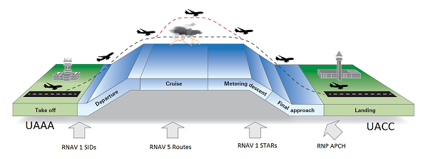
1. Implementation of Performance Based Navigation (PBN) in the upper airspace and on the Nur Sultan aerodrome.
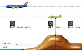
2. The transition to the QNH pressure in the aerodrome when flying below the shift echelon.
3. Transition to units of measure feet / nautical miles.
4. Transition to the unique absolute shift height of 10,000 feet.
5. The transition to the new horizontal separation intervals (5/10 nautical miles) in the airspace of the Republic of Kazakhstan.
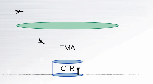
6. Modification of the vertical boundaries and the establishment of new airspace structure elements (FIR, CTA, CTR, TMA, areas of responsibility of the CPI, etc.).
In this regard, the Department of Aeronautical Information Management has accomplished the following:
Aeronautical data such as exceedance of aerodromes, runway thresholds, radio navigation tools and artificial obstacles were recalculated for all aerodromes. Recalculated data are entered into the database;
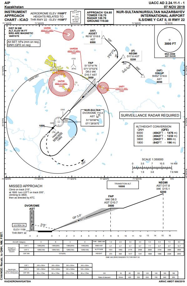
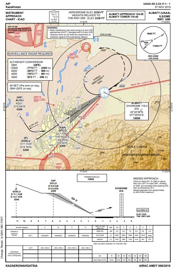
360 flight procedures (departure, arrival and landing procedures) were reviewed and have been documented at 23 aerodromes;
Parameters recalculation was performed (track angles, distance between points, minimum flight altitudes, vertical boundaries), all 92 traditional ATM routes (about 1 thousand segments);
Updated route map;
Updated aeronautical data and maps are available at the European Database (EAD);
Coordination on the modification implementation by operators and organizations, issuing flight hand-books and flight management system updates (FMS) (Jeppesen, LIDO Flightnav, Navblue Aero).
The transition is being implemented to eliminate errors in the unit measurement conversion in on-board systems.
The calculation of the minimum absolute heights of obstacles was implemented in all airways sections (MOCA - Minimum Obstacle Clearance altitude). Designed for safety lowering on airways sections.

Applying the navigation, based on the PBN features.
Jointly with the contractor, 16 flight procedures for zone navigation were developed at the Nur-Sultan aerodrome.
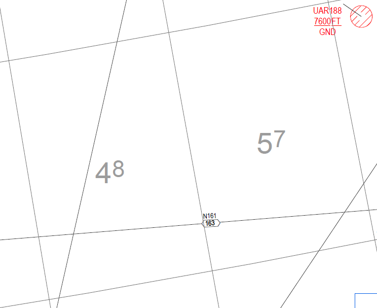
A new map with RNAV 5 area navigation routes has been developed.
A new section has been created in AIP-e - ENR 3.3 Routes of zonal navigation.
The main points on the routes have been reviewed (added, changed, deleted). Included at the database. The navigation, based on PBN features is used as an alternative approach of determining the aircraft location in space, which increases the attractiveness and operational efficiency of airspace use.

.png)
New airspace structure
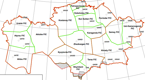
All FIR flight information areas have been revised, TMA nodal control areas. CTA control areas and CTR control areas across the Republic of Kazakhstan have been entered at 5 aerodromes.
Flight information centers are published, local control centers changed or removed.
The list of all restricted zones in databases and maps has been revised.
These modifications have been entered into the European Database (EAD).
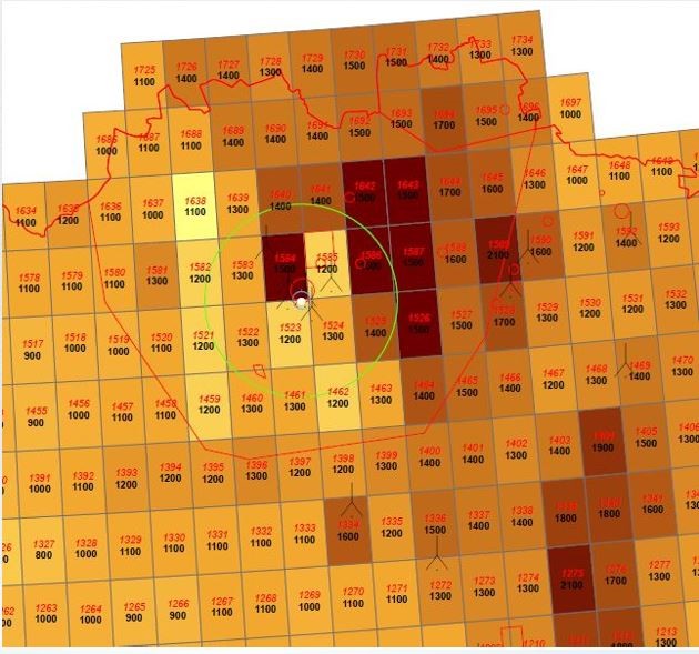
The calculation of the minimum safety heights in a degree grid taking into account the topography and artificial objects (AMA - Area Minimum Altitude) throughout the Republic of Kazakhstan.
Clearly structured airspace facilitates the flexible use of controlled and uncontrolled airspace and optimizes air traffic control processes.
Associated Events
Updated flight rules (ENR1.1 - 1.8) and other sections in the AIP with translation into English.
The orthodromic distances of all ATM route segments were calculated.
ATM contingency plan has been updated.
The absolute altitude terrain is calculated with the artificial obstacles in the area of the aerodrome in order to automatically notify the air traffic controller of an aircraft's reduction (MSAW - minimum safe altitude warning).

9965 views
 Our company
 News
News
 Activities
 Online Flight plan
 AIS
AIS